Water Data from U.S. Government Sources
Data are provided from official U.S. Government sources and are subject to any conditions, disclaimers, or other restrictions specified by the sources. WaterDataUS does not directly supply any data. Links to data sites are provided by WaterDataUS as a service to users and do not imply any endorsement or warranty by WaterDataUS.
- U.S. Department of the Interior
- U.S. Geological Survey
- Bureau of Reclamation
- U.S. Department of Commerce
- National Oceanic and Atmospheric Administration
- National Weather Service
- National Climatic Data Center
- National Ocean Service
- U.S. Department of Defense
- U.S. Army Corps of Engineers
- U.S Environmental Protection Agency
- U.S. Department of Agriculture
- Natural Reseouces Conservation Service
- Agricultural Research Service
- U.S. Forest Service
- National Science Foundation
- Recreation.GOV
Water Data from the U.S. Geological Survey (USGS)
U.S. Department of the Interior
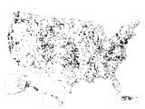
The National Water Information System (NWIS) is managed by USGS and is the Nation's principal repository of water resources data. It includes data from more than 1.5 million sites, some in operation for more than 100 years. Most NWIS data can be accessed directly at: waterdata.usgs.gov.
USGS also participates in the Water Quality Portal. The Water Quality Portal (WQP) is a cooperative service sponsored by the United States Geological Survey (USGS), the Environmental Protection Agency (EPA), the Agricultural Research Service (ARS), and the National Water Quality Monitoring Council (NWQMC). It serves data collected by over 400 state, federal, tribal, and local agencies.
Science in Your Watershed provides a comprehensive index of links to available USGS water data, projects, and relevant scientific publications by local watershed.
Additional tools are provided below to help find data in NWIS and in other USGS products and services. If you do not find what you need try contacting a local USGS Water Science Center.
It is useful to view USGS data in three broad classs:
- What is happening today... Water Now
- What happened in the past... Water Then
- What might happen in the future... Water Tomorrow
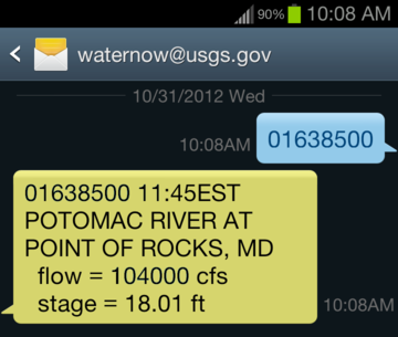
Water NowWaterNow@usgs.gov WaterAlert Real-time streamflow Real-time flood data
Real-time drought data Real-time groundwater levels
Recent groundwater levels Groundwater response to climate Real-time surface water quality |
Water ThenAnnual water data reports Instantaneous streamflow data National Water Quality Assessment
Water use in the United States
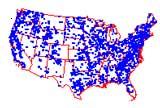
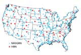
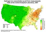
Some notable collections of USGS water data Sediment data collected by USGS is stored in NWIS and is also described in a dedicated web page and report. A Reservoir Sedimentation Database from federal agencies is also maintained by USGS. The Hydro-Climatic Data Network provides streamflow data between 1874 and 1988 and is useful in studying climate change. The National Stream Quality Accounting Network provides ongoing characterization of the concentrations and transport of sediment and chemicals in the Nation's largest rivers. USGS is the lead federal agency for monitoring of acid rain and related issues as part of the National Atmospheric Deposition Program. The groundwater Atlas and National Atlas provide many maps that summarize water resources data and related information. |
Water TomorrowUSGS collects most of the water data in the Nation, but official forecasts are made by other agencies. Forecasts are subject to any limitations and disclaimers made by the issuing agencies. In all cases, professionals should always be consulted concerning decisions that may affect safety of people or property or economic risk. StatisticsUSGS water data and statistics are used by other agencies to estimate future conditions and to assess risks such as flooding and drought. Planners and engineers use USGS water data, statistics, and other data for design of systems for water supply, flood control, environmental protection, and recreation.
|
Water Data from the Bureau of Reclamation (BOR)
U.S. Department of the Interior
Established in 1902, the Bureau of Reclamation is best known for the dams, powerplants, and canals it constructed in the 17 western states. These water projects led to homesteading and promoted the economic development of the West. Reclamation has constructed more than 600 dams and reservoirs including Hoover Dam on the Colorado River and Grand Coulee on the Columbia River. Water data from these various projects are available from regional pages:
- Agrimet - Great Plains
- Agrimet - Pacific Northwest
- Hydromet - Great Plains
- Hydromet - Pacific Northwest
Water Data from the National Weather Service (NWS)
National Oceanic and Atmospheric Administration
U.S. Department of Commerce
The National Weather Service is the primary federal agency for non-tidal water resources forecasting, including:
- A National overview of river forecasts
- Forecasts from each of 13 River Forecast Centers
Water Data from the National Centers for Environmental Information (NCEI)
National Oceanic and Atmospheric Administration
U.S. Department of Commerce
NOAA's National Centers for Environmental Information (formerly National Climatic Data Center) is responsible for preserving, monitoring, assessing, and providing public access to the Nation's treasure of climate and historical weather data and information. It provides a Quick Links page that provides easy access to the most requested data.
Water Data from the National Ocean Service (NOS)
National Oceanic and Atmospheric Administration
U.S. Department of Commerce
NOAA's National Ocean Service, Center for Operational Oceanographic Products and Services (CO-OPS) provides the national infrastructure, science, and technical expertise to monitor, assess, and distribute tide, current, water level, and other coastal oceanographic products and services that support NOAA's mission of environmental stewardship and environmental assessment and prediction. CO-OPS provides operationally sound observations and monitoring capabilities coupled with operational Nowcast Forecast modeling. Its Tides and Currents Map provides easy access to real-time tidal data across the United States, and well as related historical data.
Water Data from the U.S. Army Corps of Engineers (USACE)
U.S. Department of Defense
The Corps of Engineers does not have a central national data depository but is organized in a number of Divisions and Districts across the United States based on major river basins. The approach for providing data varies across the Districts, so it is best to explore the home page for an individual District to determine the information that is available. Those links to data that have been identified are listed below:
- Water levels of rivers and lakes (national index)
- Pacific Ocean Division
- Northwestern Division | Data
- South Pacific Division
- Southwestern Division
- Mississippi Valley Division
- Great Lakes and Ohio River Division
- North Atlantic Division
- South Atlantic Division
Water Data from the U.S. Environmental Protection Agency (USEPA)
USEPA provides a repository for much of the Nation's and State's water data, particulary data that are relevant to environmental protection programs or regulatory requirements. Its data are provided through:
- Geospatial Data Downloads – Precut geospatial extracts containing program database attributes offered in various GIS formats.
- EPA's Environmental Dataset Gateway (EDG) Clip N Ship Site – online tool that presents EPA data in a map viewer and allows you to view the data, select your area of interest, and choose an output format to save the content locally.
- Office of Water Program Databases – targeted databases, systems, and tools that expose various water related data.
USEPA participates in the Water Quality Portal. The Water Quality Portal (WQP) is a cooperative service sponsored by the United States Geological Survey (USGS), the Environmental Protection Agency (EPA), the Agricultural Research Service (ARS), and the National Water Quality Monitoring Council (NWQMC). It serves data collected by over 400 state, federal, tribal, and local agencies.
Surf Your Watershed includes some data links, links to organizations working in a watershed, and related environmental information. It is searchable by several locator indicators including zip code.
Water Data from the Natural Resources Conservation Service (NRCS)
U.S. Department of Agriculture
Forecasts of western water supply include data provided by the Natural Resources Conservation Service, which also provides state-by-state data and monthly reports for 12 western states, including Alaska.
Water Data from the Agricultural Research Service (ARS)
U.S. Department of Agriculture
The ARS Water Database is a collection of precipitation and streamflow data from small agricultural watersheds in the United States. This national archive of variable time-series readings for precipitation and runoff contains sufficient detail to reconstruct storm hydrographs and hyetographs. There are currently about 16,600 station years of data stored in the data base. Watersheds used as study areas range from .2 hectare (0.5 acres) to 12,400 square kilometers (4,786 square miles).
ARS also participates in the Water Quality Portal. The Water Quality Portal (WQP) is a cooperative service sponsored by the United States Geological Survey (USGS), the Environmental Protection Agency (EPA), the Agricultural Research Service (ARS), and the National Water Quality Monitoring Council (NWQMC). It serves data collected by over 400 state, federal, tribal, and local agencies.
Water Data from the U.S. Forest Service (USFS)
U.S. Department of Agriculture
The USDA Forest Service is responsible for protecting watersheds on the national forests from the adverse effects caused by atmospheric deposition. Thus, the Forest Service Air Program has been actively inventorying and monitoring hundreds of lakes and streams since the early 1980’s.
Chemistry of Lakes, Streams, and Bulk Deposition on and near the National ForestsWater Data from the Agricultural Research Service (ARS)
U.S. Department of Agriculture
The ARS Water Database is a collection of precipitation and streamflow data from small agricultural watersheds in the United States. This national archive of variable time-series readings for precipitation and runoff contains sufficient detail to reconstruct storm hydrographs and hyetographs. There are currently about 16,600 station years of data stored in the data base. Watersheds used as study areas range from .2 hectare (0.5 acres) to 12,400 square kilometers (4,786 square miles).
Water Data from the National Science Foundation (NSF)
The National Science Foundation sponsors Long-Term Ecological Research (LTER) projects across the United States. Although most data relate to relatively limited areas, they do cover major ecosystem types across the country. Some projects are operated in collaboration with Federal agencies such as USFS or USGS and may overlap with other data resources on this page. Available data include:
Climate and Hydrology Database Projects (CLIMDB/HYDRODB)Water Data for Recreation (Recreation.GOV)
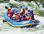 I want to find streamflow or water-level data that will tell me if a particular river will be suitable for rafting, kayaking, or fishing today.
General recreation information can be found at www.recreation.gov
Private organizations such as American Whitewater provide alternative resources that use USGS and other information for planning water-based activities.
